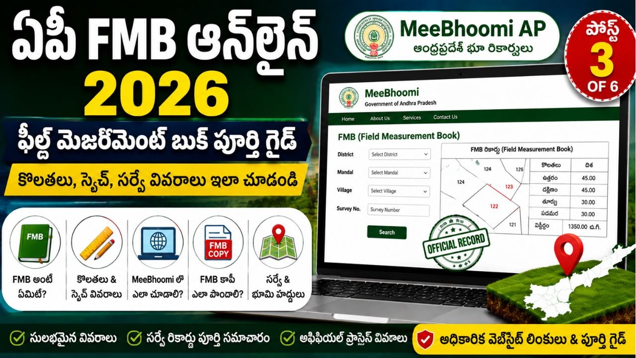
AP FMB Online 2026 – Complete MeeBhoomi AP Field Measurement Book Guide
If you are looking for detailed information about land survey measurements in Andhra Pradesh, AP FMB Online 2026 is an important topic to understand.
FMB stands for Field Measurement Book. It is a survey record associated with measurements and sketches of land parcels. The Andhra Pradesh Survey, Settlement & Land Records Department maintains and updates survey records including F.M.Bs, Village Maps, RSRs and Land Registers. The department also provides certified copies of survey records such as FMBs through the applicable official process.
For people searching for land records online, MeeBhoomi AP is an important official platform. Andhra Pradesh district government websites specifically direct citizens to MeeBhoomi for land records, and one official district page identifies MeeBhoomi as the place to view Adangal, ROR, FMB and Village Maps.
This guide explains AP FMB Online, what an FMB is, what information it contains, how it differs from Adangal and 1-B, how FMB-related services work, how to request an FMB copy through the applicable official channel, common problems, and the official government resources you should use.
What Is AP FMB?
FMB means Field Measurement Book.
It is a survey record containing measurement and sketch-related information for land parcels.
FMB records are maintained as part of the state’s survey and land-record system. The official Andhra Pradesh Survey, Settlement & Land Records information specifically lists FMBs among the land records maintained by the department.
In simple terms:
AP 1-B → Record of Rights information
Adangal → Revenue/cultivation-related information
FMB → Survey measurement and sketch information
Village Map → Broader village-level map information
This distinction is important because many people search for all these records together under MeeBhoomi AP.
What Does FMB Stand For?
FMB stands for Field Measurement Book.
It is commonly used in the context of land surveying and survey records.
An FMB can be useful when understanding:
- Survey measurements
- Sub-division details
- Parcel dimensions
- Boundary-related information
- Survey sketches
- Land parcel location in relation to survey records
The exact information available depends on the relevant survey record.
Why Is FMB Important?
FMB is particularly useful when the question is related to how a land parcel has been measured or represented in survey records.
It can help with:
- Understanding survey measurements
- Reviewing land boundaries
- Checking subdivision information
- Comparing survey information with other land records
- Understanding the shape or sketch of a parcel
- Supporting survey-related verification
- Identifying possible discrepancies in survey records
The Survey Department states that maintenance survey operations include measurement, mapping and incorporation of new subdivisions into permanent land records.
What Information Is Available in an FMB?
The exact contents can vary according to the record and survey history.
An FMB-related record may contain information such as:
| Information | Purpose |
|---|---|
| District | Identifies location |
| Mandal | Revenue/survey jurisdiction |
| Village | Revenue village |
| Survey Number | Identifies land parcel |
| Sub-Division | Identifies subdivided parcel |
| Measurements | Survey dimensions |
| Sketch | Representation of parcel |
| Boundaries | Boundary-related information |
| Adjacent Survey Details | Nearby parcels where represented |
| Survey References | Related survey information |
The actual record should be examined rather than assuming that every FMB contains every field.
What Is the Difference Between FMB and Adangal?
FMB and Adangal serve different purposes.
FMB
FMB primarily relates to survey measurements and sketches.
Adangal
Adangal is generally associated with revenue and cultivation-related land information.
Comparison
| Feature | FMB | Adangal |
|---|---|---|
| Main purpose | Survey measurement | Revenue/cultivation information |
| Sketch | Important | Not its primary purpose |
| Measurements | Important | May contain extent-related information |
| Cultivation details | Not primary | Commonly associated |
| Boundary understanding | Useful | Not primary |
| Survey record | Yes | Revenue record |
If you want to understand the Adangal record in detail, read our previous guide:
AP Adangal Online 2026 – Easy Complete MeeBhoomi AP Guide
What Is the Difference Between FMB and AP 1-B?
This is another important distinction.
AP 1-B is associated with the Record of Rights.
FMB is associated with survey measurement and sketch information.
| Feature | AP 1-B | FMB |
|---|---|---|
| Record type | Record of Rights | Survey record |
| Main purpose | Rights-related information | Measurement/sketch |
| Survey number | May be available | Important |
| Extent | May be available | Survey measurement context |
| Sketch | Not primary | Important |
| Boundaries | Record-related | Survey-related |
| Survey measurement | Not primary | Primary purpose |
For more information about ROR 1-B, see our AP 1-B Online 2026 guide.
Internal Link: Once the Post 2 URL is confirmed/published, connect the anchor text AP 1-B Online 2026 to that article. We should not insert an unverified URL.
What Is MeeBhoomi AP?
MeeBhoomi AP is the Andhra Pradesh online land-record platform.
Official district government websites direct citizens to the MeeBhoomi portal for land records. The Tirupati District Government describes MeeBhoomi as an online land-record portal launched by the Andhra Pradesh Revenue Department, while NTR District Government provides MeeBhoomi as its land-record link.
An official Andhra Pradesh district page also specifically states that MeeBhoomi is used to view Adangal, ROR, FMB and Village Maps.
This makes MeeBhoomi AP an important starting point when checking available online land-record information.
Can FMB Be Viewed Online?
The availability of online FMB information can depend on the specific land record and the current government digital system.
Therefore, do not assume that every FMB record can always be directly downloaded from the same online screen.
For some records, an official service or certified-copy request may be applicable.
The Andhra Pradesh Survey, Settlement & Land Records Department states that certified copies of survey records, including FMBs, can be supplied on payment of the prescribed fee.
AP FMB Online Search – General Process
The exact MeeBhoomi interface can change. Therefore, use the following as a practical guide rather than assuming that every button will always have the same wording.
Step 1: Open MeeBhoomi AP
Open the official MeeBhoomi AP website.
Step 2: Select the Relevant Land Record Service
Look for the currently available FMB, survey record or related land-record option.
Step 3: Select District
Choose the district where the land is located.
Step 4: Select Mandal
Select the relevant mandal.
Step 5: Select Village
Choose the correct revenue village.
Step 6: Enter Survey Number
Enter the survey number associated with the land.
If a subdivision exists, carefully verify the subdivision information.
Step 7: Search the Available Record
Submit the search using the current official interface.
Step 8: Review the Information
Check whether the available information corresponds to your land.
Pay attention to:
- Survey number
- Subdivision
- Measurements
- Sketch
- Boundaries
- Village
- Related survey details
Step 9: Check Whether Download or Print Is Available
If the current official service provides a download or print facility, use the option displayed there.
If a certified copy is required, follow the applicable official service procedure.
AP FMB Copy – Official Process
One important distinction is between viewing available online information and obtaining a certified copy.
The Andhra Pradesh Government’s GSWS/MeeSeva user manual for the FMB Copy service shows an official process under the Revenue Department. It instructs the user to select FMB Copy, enter District, Mandal, Village and Survey Number, and then provide applicant details.
Therefore, if you specifically need an FMB copy rather than merely checking available online information, the applicable official FMB Copy service should be followed.
FMB Copy Application – Step-by-Step
Step 1: Select FMB Copy Service
Use the applicable official MeeSeva/GSWS Revenue service for FMB Copy.
The official user manual identifies FMB Copy as a Revenue Department service.
Step 2: Enter Land Details
The official manual specifies fields including:
- District
- Mandal
- Village
- Survey Number
These details are used to obtain the relevant FMB information.
Step 3: Enter Applicant Details
The official manual includes applicant information such as:
- Applicant name
- Father/Husband name
- Gender
- Address
- District
- Village/Ward
- Door/House number
- Locality/Landmark
- PIN code
- Mobile number
- Ration Card number
The exact fields displayed may depend on the current version of the service.
Step 4: Submit the Request
Review the entered information carefully and submit the application through the applicable official service channel.
Step 5: Keep the Application Details
After submitting the request, keep the acknowledgement or reference information provided by the service.
Step 6: Follow the Applicable Delivery/Collection Process
Follow the current official instructions for receiving or accessing the requested FMB copy.
What Documents May Be Needed for FMB Copy?
The exact requirements can vary depending on the service and applicant.
Keep the following information/documents ready where applicable:
- Survey number
- District
- Mandal
- Village
- Applicant identification details
- Address details
- Mobile number
- Email address, if required
- Relevant land documents
- Previous survey records, if available
Do not assume that every application will require all of these documents.
Always check the current official service requirements before submitting.
AP FMB and Land Boundaries
FMB is particularly relevant when discussing survey boundaries.
A landowner may need survey-related information when:
- A boundary is unclear
- Adjacent land is disputed
- A subdivision has occurred
- Old survey records need comparison
- A survey number needs verification
- A property is being measured
- A boundary demarcation request is being considered
The Survey Department states that it undertakes demarcation of private land boundaries at the request of landholders, subject to the prescribed fee.
Can FMB Be Used to Check Land Boundaries?
FMB can be an important survey record for understanding the recorded measurements and sketch.
However, an FMB should not automatically be treated as a substitute for a current physical survey in every dispute or transaction.
If there is a serious boundary dispute, the appropriate survey/revenue process should be followed.
FMB and Land Subdivision
FMB is also important in the context of land subdivision.
The Survey Department’s official information states that maintenance survey operations include measurement, mapping and incorporation of new subdivisions into permanent land records.
Therefore, if a large survey number has been divided into smaller parcels, the relevant subdivision information should be carefully checked.
What If the FMB Information Is Wrong?
Do not immediately assume that the online record is incorrect.
First compare:
- FMB
- AP 1-B / ROR
- Adangal
- Pattadar Passbook
- Registered documents
- Village Map
- Previous survey records
Then identify exactly where the discrepancy occurs.
Possible discrepancies include:
- Survey number
- Subdivision
- Measurement
- Boundary
- Extent
- Sketch
- Village information
If a correction or survey action is required, contact the relevant revenue/survey authority through the applicable official process.
FMB Record Not Available Online
Not finding an FMB online does not automatically mean that no survey record exists.
The Andhra Pradesh Survey Department itself notes that records from older surveys may not be fully available in all villages and that some old paper records may have been lost or damaged.
Therefore, if an online record is unavailable:
- Verify the survey number.
- Verify the village and mandal.
- Check related land records.
- Contact the relevant survey/revenue office if necessary.
- Ask about the applicable certified-copy or survey-record service.
Why FMB Digitization Matters
Digitization makes survey records easier to preserve, manage and access.
An official Visakhapatnam District page reports digitization work involving Field Measurement Books under the Digital India Land Records Modernization Programme in the district.
However, digitization status may differ by location and record.
Therefore, online availability should always be checked for the specific land parcel.
FMB vs Village Map
Both are survey-related records, but they serve different purposes.
FMB
Focuses on individual survey parcel measurements and sketches.
Village Map
Provides a broader map representation of survey parcels within a village.
| Feature | FMB | Village Map |
|---|---|---|
| Individual parcel | Strong relevance | May show |
| Measurements | Important | Not primary |
| Sketch | Important | Map-level |
| Village-wide view | No | Yes |
| Boundary understanding | Detailed survey context | Broader map context |
The Survey Department officially maintains both FMBs and Village Maps.
Benefits of AP FMB Online Services
Using MeeBhoomi AP and applicable official survey services can help citizens:
- Check available survey information
- Understand land measurements
- Review survey-related records
- Compare records
- Identify possible discrepancies
- Prepare for survey-related applications
- Understand subdivision information
- Reduce unnecessary confusion about different land records
AP FMB Online – Quick Checklist
| Requirement | Keep Ready |
|---|---|
| District | Yes |
| Mandal | Yes |
| Village | Yes |
| Survey Number | Important |
| Subdivision Number | If applicable |
| Applicant Details | For FMB Copy service |
| Mobile Number | If requested |
| Address | If requested |
| Related Land Documents | Useful |
| Previous Survey Records | Useful |
Common AP FMB Problems
Survey Number Not Found
Check whether the survey number has changed, been subdivided or is entered incorrectly.
Subdivision Missing
Check whether the parcel was subdivided after the original survey.
FMB Not Available Online
The record may not yet be available in the digital system. Older records may also have availability limitations.
Measurement Difference
Compare the FMB with other survey and revenue records before concluding that there is an error.
Boundary Dispute
For a serious boundary issue, use the applicable official survey/demarcation process rather than relying only on an online record.
Important Tips for MeeBhoomi AP FMB Search
- Use the official MeeBhoomi AP portal.
- Enter the survey number carefully.
- Check subdivision information.
- Confirm the correct village.
- Keep your registered documents available.
- Compare FMB with AP 1-B and Adangal.
- Use Village Maps when broader map information is required.
- Do not assume that every old FMB is available online.
- Use the official FMB Copy service if a certified copy is required.
- Do not rely on unofficial websites claiming to issue government survey records.
- For boundary disputes, follow the official survey process.
Related SwarnaGramam Pages
Previous Guide
AP 1-B Online 2026 – Complete MeeBhoomi AP ROR Guide
Note: This URL follows the published Post 2 slug. If your WordPress permalink is different, replace it with the exact live URL.
Earlier Guide
AP Adangal Online 2026 – Easy Complete MeeBhoomi AP Guide
This is Post 1 of the MeeBhoomi AP cluster.
Current Guide
AP FMB Online 2026 – Complete MeeBhoomi AP Field Measurement Book Guide
Next Guide
AP Village Map Online 2026 – Search & Land Map Guide
The exact URL should be added after the next article is published.
Other Upcoming MeeBhoomi AP Guides
- AP Land Ownership Details & Pattadar Passbook 2026
- AP Land Mutation & Land Record Correction 2026
These should be linked after publication.
Official Andhra Pradesh Government Links
MeeBhoomi AP
Andhra Pradesh district government websites identify MeeBhoomi as the official online land-record portal.
Survey, Settlement & Land Records
Andhra Pradesh Survey, Settlement & Land Records – Krishna District Government
This official government page explains the department’s role in maintaining Village Maps, FMBs, RSRs and Land Registers and discusses certified copies of survey records.
AP Revenue Services
Revenue Services – NTR District Government
This official district government page lists Revenue Department services available through MeeSeva.
FMB Copy Official User Manual
FMB Copy – Government of Andhra Pradesh GSWS/MeeSeva Manual
The official manual describes the FMB Copy service and the land/applicant details used in the request.
SwarnaGramam Homepage
For more Andhra Pradesh government services, land-record guides and MeeBhoomi AP information:
Frequently Asked Questions
What is FMB in Andhra Pradesh?
FMB means Field Measurement Book. It is a survey record containing measurement and sketch-related information.
What is AP FMB Online?
AP FMB Online refers to accessing available Field Measurement Book-related information through Andhra Pradesh’s online land-record and government service systems.
Is FMB available through MeeBhoomi AP?
MeeBhoomi is the official land-record portal referenced by Andhra Pradesh district government websites, and official district information identifies FMB among the land records associated with MeeBhoomi.
What details are needed for an FMB search?
District, mandal, village and survey number are important. The official FMB Copy service manual specifically identifies these fields.
Can I get an FMB copy?
The Andhra Pradesh Survey, Settlement & Land Records Department states that certified copies of survey records including FMBs can be supplied on payment of the prescribed fee.
Is FMB the same as Adangal?
No. FMB primarily relates to survey measurements and sketches, while Adangal is associated with revenue and cultivation-related information.
Is FMB the same as AP 1-B?
No. AP 1-B is associated with Record of Rights, whereas FMB is primarily a survey measurement and sketch record.
Can FMB prove land ownership?
FMB is a survey record and should not automatically be treated as the sole proof of legal ownership or title.
Can FMB help with boundary verification?
Yes, FMB can be useful for understanding recorded survey measurements and sketches. For an actual boundary dispute, follow the applicable official survey/demarcation procedure.
What if my FMB is not available online?
Verify your survey details and check the applicable official survey/revenue service. Older records may not always be fully available digitally.
What is FMB Copy?
FMB Copy is an official service through which an applicant can request the applicable Field Measurement Book record. The official GSWS/MeeSeva manual describes the service under the Revenue Department.
Can I download FMB directly?
Availability of direct download depends on the current government portal and record. If a certified copy is required, use the applicable official FMB Copy service.
What should I do if FMB and my documents show different measurements?
Compare the FMB with your registered documents, Adangal, 1-B, Village Map and other relevant survey records. If the discrepancy remains, follow the appropriate official survey/revenue process.
Conclusion
AP FMB Online 2026 is an important part of understanding Andhra Pradesh land survey records.
FMB primarily deals with field measurements, survey sketches and parcel-related survey information, while AP 1-B and Adangal serve different purposes.
MeeBhoomi AP is an important official online land-record platform, and Andhra Pradesh district government websites specifically identify MeeBhoomi in connection with land records including FMB and other records.
If you need only to check available online information, start with the official MeeBhoomi portal. If you specifically require an FMB copy, follow the applicable official FMB Copy service.
For property purchases, boundary disputes or legal matters, do not rely on one online record alone. Compare the relevant survey, revenue and registered documents and use the appropriate official process when a correction, demarcation or certified record is required.