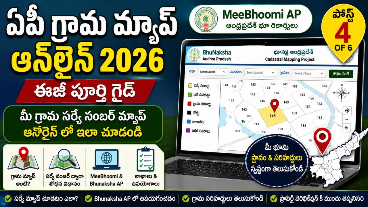
AP Village Map Online 2026 – Complete MeeBhoomi AP Guide
If you are searching for an AP Village Map Online, you may want to understand the location of survey numbers, land parcels, village boundaries and other survey-related information in Andhra Pradesh.
Village Maps are an important part of the state’s survey and land-record system. The Andhra Pradesh Survey, Settlement & Land Records Department maintains and updates Village Maps, FMBs, RSRs and Land Registers. The department also provides various survey-record services and map-related facilities.
For citizens searching online, MeeBhoomi AP is an important land-record platform. Official Andhra Pradesh district government websites direct citizens to MeeBhoomi for land records, and the Vizianagaram District Government specifically states that Adangal, ROR, FMB and Village Maps can be viewed through MeeBhoomi.
At the same time, Andhra Pradesh also has the official Bhunaksha AP platform for cadastral mapping. The Bhunaksha AP website describes itself as a cadastral mapping platform developed for Andhra Pradesh and says that it integrates with existing land-record systems, including MeeBhoomi.
Therefore, when searching for AP Village Map Online, it is useful to understand both MeeBhoomi AP and Bhunaksha AP instead of treating them as completely separate land-record systems.
What Is an AP Village Map?
An AP Village Map is a survey-related map representing land parcels and survey information within a village.
It can be useful for understanding the broader spatial arrangement of survey numbers and land parcels.
A Village Map may help you understand:
- Village survey layout
- Survey numbers
- Relative location of land parcels
- Adjacent survey numbers
- Roads and other mapped features, where represented
- Village-level survey information
- Relationship between different survey parcels
The exact information visible on a digital map depends on the available government survey data and the current online system.
The Survey, Settlement & Land Records Department officially lists Village Maps among the land records it maintains and updates.
What Is MeeBhoomi AP?
MeeBhoomi AP is Andhra Pradesh’s online land-record platform.
Official district government websites continue to direct citizens to the MeeBhoomi portal for land records. For example, NTR District’s official land-record page directs users to MeeBhoomi, while Tirupati District describes MeeBhoomi as the online land-record portal launched by the Andhra Pradesh Revenue Department.
MeeBhoomi AP is associated with land-record information such as:
- Adangal
- ROR / 1-B
- FMB
- Village Maps
- Other available land information
The exact online services and interface can change, so users should follow the options currently displayed on the official government portal.
What Is Bhunaksha AP?
Bhunaksha AP is the Government of Andhra Pradesh’s cadastral mapping platform.
The official Bhunaksha website identifies itself as:
Bhunaksha – Survey, Settlements and Land Records – Government of Andhra Pradesh.
It describes the platform as cadastral mapping software designed for Andhra Pradesh and says that it provides land maps and geo-referenced spatial data. It also states that integration with the MeeBhoomi portal enhances access to land records and maps.
This distinction is important:
MeeBhoomi AP → broader online land-record access
Bhunaksha AP → cadastral / map-focused information
Both are relevant when researching AP Village Map Online.
Why Is AP Village Map Important?
A village map can be useful when you need a broader visual understanding of land parcels.
For example, a person may know:
- District
- Mandal
- Village
- Survey number
but may not understand where that survey parcel sits relative to surrounding survey numbers.
A map can make this information easier to understand.
Common Uses
An AP Village Map may be useful for:
- Understanding survey-number locations
- Reviewing surrounding survey parcels
- Preliminary land research
- Understanding village-level survey layout
- Comparing survey records
- Supporting survey-related verification
- Understanding the relationship between adjacent parcels
- Preparing for further revenue or survey enquiries
However, an online map should not automatically be treated as a substitute for a certified survey record or a physical boundary survey.
AP Village Map vs FMB
This is one of the most important differences to understand.
Both are survey-related records, but they have different purposes.
Village Map
A Village Map provides a broader village-level representation of survey parcels and mapped features.
FMB
FMB, or Field Measurement Book, is more focused on individual survey measurements and sketches.
| Feature | Village Map | FMB |
|---|---|---|
| Village-level view | Yes | No |
| Individual survey parcel | Yes, where mapped | Yes |
| Measurements | Not primary | Important |
| Detailed parcel sketch | Limited/based on map | Important |
| Survey number | Important | Important |
| Broader surrounding parcels | Useful | Limited |
| Survey measurement details | Not primary | Primary purpose |
For a detailed explanation of FMB, read:
AP FMB Online 2026 – Complete MeeBhoomi AP Field Measurement Book Guide
Once the FMB article is published with its final URL, connect that anchor to the live article.
AP Village Map vs AP 1-B
AP 1-B and Village Map are also different.
AP 1-B is associated with Record of Rights information.
Village Map is a survey/map record.
| Feature | AP 1-B | Village Map |
|---|---|---|
| Main purpose | Rights-related information | Map/spatial information |
| Survey number | May be available | Important |
| Land extent | May be available | Not primary |
| Map representation | Not primary | Important |
| Rights information | Important | Not primary |
| Adjacent parcels | Limited | Useful |
For the detailed ROR guide, refer to the AP 1-B Online 2026 article in this MeeBhoomi AP cluster.
AP Village Map vs Adangal
Adangal and Village Map also serve different purposes.
Adangal is generally associated with revenue and cultivation-related information.
Village Map is primarily associated with survey and spatial information.
For example:
Adangal → land/revenue/cultivation-related record
Village Map → survey/map-related record
Our first article in this cluster covers Adangal in detail:
AP Adangal Online 2026 – Easy Complete MeeBhoomi AP Guide
How to Check AP Village Map Online
The online interface may change, and the exact map service available for a particular village can depend on the digitisation and mapping data available.
Therefore, use the following as a general process.
Step 1: Open the Official Land Map Platform
For map-focused information, use the official Bhunaksha AP platform.
For broader land-record information, use the official MeeBhoomi AP platform.
Step 2: Select the Relevant Location
Depending on the current interface, select the relevant administrative location such as:
- District
- Mandal
- Village
Step 3: Select the Village
Choose the correct revenue village.
Make sure you select the correct village if multiple villages have similar names.
Step 4: Search the Survey Number
If the map service provides a survey-number search, enter the relevant survey number.
Check the number carefully.
Step 5: Review the Map
After selecting the applicable location or survey information, review the map displayed by the official system.
Look for:
- Survey number
- Parcel location
- Adjacent survey numbers
- Village layout
- Mapped boundaries
- Other available map information
Step 6: Compare With Your Documents
Do not immediately assume that the map alone establishes the legal position of your property.
Compare it with your:
- Sale deed
- AP 1-B
- Adangal
- FMB
- Pattadar Passbook
- Village Map
- Other relevant documents
Step 7: Use the Applicable Official Service
If you require a certified record, correction, subdivision, demarcation or other survey service, follow the applicable official government process.
How to Search a Village Map by Survey Number
A survey number is one of the most useful references when searching for a particular land parcel.
Before starting the search, keep the following information ready:
- District
- Mandal
- Village
- Survey number
- Sub-division number, if applicable
If the property was subdivided, the current survey/subdivision reference may differ from an old document.
Therefore, if your old document shows one reference and the online map shows another, investigate the change before reaching a conclusion.
What Is a Survey Number on a Village Map?
A survey number is used to identify a particular land parcel within the survey system.
On a digital cadastral map, the survey number can help identify the parcel and understand its relationship with surrounding parcels.
For example, a map might show:
- Survey No. 101
- Survey No. 102
- Survey No. 103
- Survey No. 104
The map can help you understand how these parcels are positioned relative to one another.
The exact labels and map information depend on the available government cadastral data.
What Is a Sub-Division Number?
A survey parcel can be divided into smaller parcels through applicable revenue and survey processes.
These may be represented through subdivision references.
For example, a survey number may have subdivisions such as:
- 101/1
- 101/2
- 101/3
The exact format can vary.
If your property is subdivided, always check the current subdivision reference instead of searching only with the old parent survey number.
Can AP Village Map Show Land Boundaries?
A digital cadastral map can provide map-based representation of parcels and boundaries available in the government survey data.
However, an online map should not automatically be treated as a physical boundary demarcation.
There is an important difference between:
Map representation → what the recorded survey map shows
Physical demarcation → establishing the boundary on the ground through the applicable survey process
The Andhra Pradesh Survey Department states that it undertakes demarcation of private land boundaries at the request of landholders on payment of the prescribed fee.
Therefore, if the issue concerns an actual boundary dispute, use the official survey/demarcation process rather than relying only on an online map.
Can Village Map Be Used for Property Verification?
Yes, a Village Map can be useful as one part of preliminary property verification.
It can help you understand the survey location and surrounding parcels.
But complete property verification may require several records.
Depending on the situation, check:
- Registered sale deed
- Link documents
- AP 1-B / ROR
- Adangal
- FMB
- Village Map
- Pattadar Passbook
- Mutation records
- Encumbrance Certificate
- Other relevant government records
The exact documents required depend on the property and transaction.
Is AP Village Map Proof of Ownership?
No.
A Village Map is primarily a survey/map-related record.
It should not be treated as the sole proof of ownership or legal title.
Ownership verification can involve registered documents and other revenue and survey records.
For a major property purchase, sale or dispute, proper legal and revenue verification is advisable.
What If the Village Map Shows a Different Survey Number?
Do not immediately assume that the online map is wrong.
First check:
- Current survey number
- Old survey number
- Subdivision number
- Village
- Mandal
- FMB
- AP 1-B
- Adangal
- Registered documents
Survey records can change because of subdivision, resurvey, corrections or other revenue/survey processes.
If the discrepancy remains, approach the relevant survey/revenue authority through the applicable official process.
What If My Village Is Not Showing Online?
Not every historical record or map may be available digitally in the same way.
The Survey Department states that, because many surveys were conducted decades ago, records for some villages are not fully available and some old paper records have been lost or are in poor physical condition.
Therefore, if your village or map is unavailable:
- Check the spelling of the village.
- Confirm the correct mandal.
- Confirm the district.
- Try the current official map platform.
- Check related land records.
- Contact the relevant survey/revenue office if necessary.
Do not conclude that the land has no record simply because it is not visible in one online search.
AP Village Map and Resurvey
Resurvey and maintenance survey activities can affect how land information is represented in survey records.
The Andhra Pradesh Survey Department states that maintenance survey operations include measurement, mapping and incorporation of new subdivisions into permanent land records.
This is why current records should be compared with older documents where necessary.
If your property has undergone subdivision or another survey-related change, use the current official record as part of your verification.
AP Village Map and Land Subdivision
Village Maps can be useful for understanding how parcels are arranged after subdivision.
However, the map alone does not complete the subdivision process.
The official Survey Department handles subdivision of patta lands on request, subject to the applicable process and prescribed fee.
If you need a legal or revenue subdivision, follow the official process rather than attempting to interpret the map as an approval.
AP Village Map and Boundary Disputes
A map can help identify what is represented in the survey records.
But when two landowners disagree about an actual ground boundary, an online map may not be sufficient.
In such cases, relevant records may include:
- FMB
- Village Map
- Survey records
- Registered documents
- ROR / 1-B
- Adangal
- Subdivision records
The applicable survey/demarcation process should then be followed.
Benefits of AP Village Map Online
Using official digital map services can make preliminary land research easier.
Key Benefits
- Easier access to map information
- Visual understanding of survey parcels
- Better understanding of neighbouring survey numbers
- Useful preliminary verification
- Easier comparison with other land records
- Helps identify possible discrepancies
- Useful before approaching survey/revenue authorities
- Can reduce confusion when reading traditional survey records
AP Village Map Online – Quick Process
| Step | Action |
|---|---|
| 1 | Open official AP land-map service |
| 2 | Select District |
| 3 | Select Mandal |
| 4 | Select Village |
| 5 | Search/select survey information |
| 6 | View available map |
| 7 | Check survey numbers |
| 8 | Compare with documents |
| 9 | Identify discrepancies |
| 10 | Follow official survey process if required |
Important Documents to Keep Ready
If you are checking a village map for your own property, it is useful to keep relevant documents available.
| Document | Why It May Help |
|---|---|
| Sale Deed | Property transaction details |
| AP 1-B / ROR | Rights-related information |
| Adangal | Revenue/cultivation information |
| FMB | Detailed survey measurement |
| Pattadar Passbook | Pattadar-related information |
| Village Map | Map/spatial information |
| Mutation Record | Revenue change information |
| EC | Registration-related transaction history |
Not every situation requires all of these documents.
Common AP Village Map Problems
Survey Number Not Showing
Check whether:
- The number was entered correctly.
- The survey number has a subdivision.
- The village is correct.
- The current map database contains the record.
Village Not Found
Check the district, mandal and village combination carefully.
Boundary Looks Different
Compare the map with FMB and other survey records before concluding that there is an error.
Old Survey Number
Check whether the property has undergone subdivision, resurvey or another survey-related change.
Map Is Not Available
Digital availability can vary by location and record. Older survey records may have availability limitations.
Online Map and Physical Boundary Differ
Do not try to resolve a serious boundary dispute only through the online map. Use the applicable official survey/demarcation process.
MeeBhoomi AP and Bhunaksha AP – Difference
This is especially important for people searching Google for MeeBhoomi AP Village Map.
| Platform | Main Role |
|---|---|
| MeeBhoomi AP | Online land-record access |
| Bhunaksha AP | Cadastral mapping |
| FMB | Detailed survey measurement/sketch record |
| Village Map | Village-level survey/map information |
| AP 1-B | Record of Rights |
| Adangal | Revenue/cultivation-related information |
The official Bhunaksha AP website specifically says its integration with MeeBhoomi enhances access to land records and maps.
Therefore, MeeBhoomi AP and Bhunaksha AP should be understood as connected parts of the broader digital land-record ecosystem rather than simply competing websites.
Official AP Village Map Online Link
For map-focused information, use the official Government of Andhra Pradesh Bhunaksha portal:
Bhunaksha AP – Government of Andhra Pradesh
For broader land-record information, use:
MeeBhoomi AP – Official Land Records Portal
Always check that the website belongs to the Government of Andhra Pradesh before entering personal or property information.
Official Andhra Pradesh Government Information
Survey, Settlement & Land Records Department
Settlement Survey & Land Records – Andhra Pradesh Government
This official government page explains the Survey Department’s functions, including maintenance of Village Maps and FMBs, maintenance survey operations, boundary demarcation, subdivision and certified copies of survey records.
NTR District Land Records
Land Records – NTR District Government
The official district page directs citizens to MeeBhoomi for land-record services.
Tirupati District Land Records
Land Records – Tirupati District Government
The official district government page provides information about MeeBhoomi and its land-record services.
Related SwarnaGramam Pages
AP Adangal Online
AP Adangal Online 2026 – Easy Complete MeeBhoomi AP Guide
This is the first article in our MeeBhoomi AP cluster and covers Adangal in detail.
AP 1-B Online
AP 1-B Online 2026 – Complete MeeBhoomi AP ROR Guide
This is the second article in the cluster.
AP FMB Online
AP FMB Online 2026 – Complete MeeBhoomi AP Field Measurement Book Guide
This is the previous article in the cluster and explains FMB, survey measurements and FMB Copy services.
Current Article
AP Village Map Online 2026 – Easy Complete MeeBhoomi AP Land Map Guide
Upcoming Article
AP Land Ownership Details & Pattadar Passbook 2026 – Complete Guide
The exact internal URL will be added after that article is published.
Another Upcoming Article
AP Land Mutation & Land Record Correction 2026 – Complete Guide
The exact internal URL will be added after publication.
SwarnaGramam Homepage
For more Andhra Pradesh government services, land-record guides, GSWS information and MeeBhoomi AP updates:
Frequently Asked Questions
What is AP Village Map Online?
AP Village Map Online refers to accessing Andhra Pradesh village-level survey and cadastral map information through the government’s digital land-record and mapping systems.
Which website is used for AP Village Map?
For map-focused cadastral information, the Government of Andhra Pradesh provides the official Bhunaksha AP platform. MeeBhoomi is the broader land-record portal.
Is AP Village Map available through MeeBhoomi AP?
Official Andhra Pradesh district information identifies MeeBhoomi as a platform through which land records including Village Maps can be accessed.
What is Bhunaksha AP?
Bhunaksha AP is the Government of Andhra Pradesh’s cadastral mapping platform for land maps and spatial survey information.
What is the difference between MeeBhoomi AP and Bhunaksha AP?
MeeBhoomi is focused on online land-record access, while Bhunaksha is focused on cadastral mapping. The official Bhunaksha platform states that it integrates with MeeBhoomi.
Can I search a Village Map using a survey number?
Where the current official map service provides survey-number search, the survey number can be used to identify the applicable parcel or map information.
Can Village Map prove ownership?
No. A Village Map is primarily a survey/map record and should not be treated as the sole proof of ownership.
Can Village Map show land boundaries?
It can show recorded parcel/map boundaries where the applicable digital survey data is available. However, an online map is not necessarily a substitute for physical boundary demarcation.
What should I do if the Village Map and FMB differ?
Compare both records with AP 1-B, Adangal and registered documents. If the discrepancy remains, use the applicable official survey/revenue process.
What if my village is not available online?
Check the location details carefully. Some historical survey records may not be fully digitised or available because of the condition or loss of older records.
Can I use Village Map before buying land?
Yes, it can be useful for preliminary verification. However, complete property verification should include other relevant revenue, survey and registration documents.
Can I use Village Map for a boundary dispute?
It can help understand the recorded map information, but an actual boundary dispute should be handled through the appropriate official survey/demarcation process.
Is FMB better than Village Map?
Neither is simply “better.” They serve different purposes. FMB provides more detailed survey measurement/sketch information, while a Village Map provides a broader village-level map view.
What documents should I compare with a Village Map?
Depending on the situation, compare the map with FMB, AP 1-B, Adangal, Pattadar Passbook, registered documents and mutation records.
Conclusion
AP Village Map Online 2026 is an important resource for understanding the spatial and survey-related side of Andhra Pradesh land records.
The state’s Survey, Settlement & Land Records Department maintains Village Maps and FMBs as part of the land-record system.
For online access, MeeBhoomi AP remains an important official land-record platform, while Bhunaksha AP provides a dedicated cadastral mapping environment. The official Bhunaksha platform confirms its integration with MeeBhoomi for improved access to land records and maps.
If you are checking a property, use the Village Map as one part of the verification process. Compare it with FMB, AP 1-B, Adangal, Pattadar Passbook, registered documents and other applicable records.
For serious boundary disputes, ownership issues or property transactions, do not rely on an online map alone. Follow the appropriate official survey, revenue and legal verification process.